Help
/
Drawing Tools
How to guides
Drawing Tools
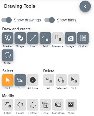
DataNation Drawing Tools allow you to customize your maps, annotate features, and create informative visualizations.
Drawing Tools

You can use the Drawing Tools to:
- Add text labels to specific points on your map.
- Attach measurement labels to lines or shapes you’ve drawn.
- Useful for indicating distances or areas.
- Enhance your maps by adding symbols or emojis.
- Expressive icons can represent features or points of interest.
- Draw lines with customizable colors, types, and widths.
- Add predefined shapes (e.g., triangles) to your map.
- Specify stroke and fill settings for shapes.
Find out more in the following sections.


